One day, a thought strikes me. I've always been working on trying to understand things from all the wrong angle and it made working on my real project a big pain in the neck. Endless MOOCs, long-winded how-to's books, ads-laden step-by-step sites and paywall training sites.
So, this new year, I've decided to take it down a notch and systematically choose my battlefield. Wildlife species data has always been mystery at me. As we all know, biologists hold them close to their hearts to the point of annoyance sometimes (those movies with scientists blindly running after some rare orchids or snakes or something like that really wasn't kidding). Hey...I get it and I totally agree - the data that belongs to the organization has to be treated with utmost confidentiality and all by the experts that collects them. Especially since we all know that they are not something so easily retrieved. Even more so, I optimistically support for the enthusiasm to be extended to their data cleaning and storing too while they're at it. But it doesn't mean I have to like the repercussions. Especially not when someone expects a habitat suitability map from me and I have no data to work with and all I had is a ping-pong game of exchanging jargon in the air with the hopes that the other player gets what you mean cough up something you can work with. Yes...there is not a shred of shame here when I talk about how things work in the world, but it is what it is and I'm not mad. It's just how it works in the challenging world of academics and research.
To cater for my lack of knowledge in biological data sampling and analysis, I actually signed up for the 'Wildlife Study Design and Data Analysis' organized by Biodiversity Conservation Society Sarawak (BCSS for short) or Pertubuhan Biodiversiti Konservasi Sarawak. It just ended yesterday and I can't say I did not cry internally. From pain and gratitude and accomplishment of the sort. 10 days of driving back and forth between the city center and UNIMAS was worth the traffic shennanigans.
It is one of those workshops where you really do get down to the nitty-gritty part of understanding probability distribution from scratch; how to use it for your wildlife study data sampling design and analyzing them to obtain species abundance, occupancy or survival. And most importantly, how Bayes has got anything to do with it. I've been hearing and seeing Bayesian stats, methods and network on almost anything that involves data science, R and spatial stats that I am quite piffed that I did not understand a thing. I am happy to inform that now, I do. Suffice to say that it was a bootcamp well-deserved of the 'limited seats' reputation and the certificate really does feel like receiving a degree. It dwindles down to me realizing a few things I don't know:
- I did not know that we have been comparing probabilities instead of generating a 'combined' one based on a previous study all these years.
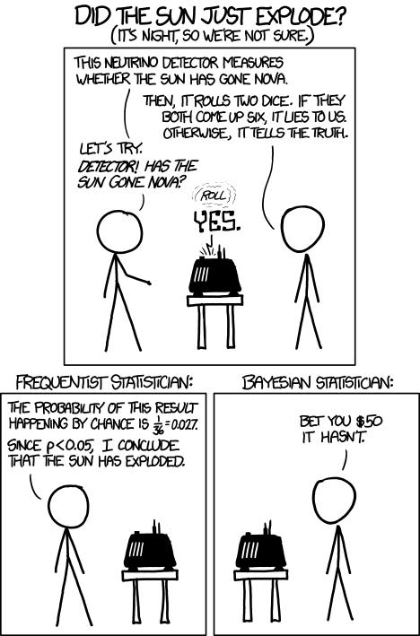
- I did not know that Ronald Fisher had such strong influence that he could ban the usage of Bayesian inference by deeming it unscientific.
- I did not know that, for Fisher, if the observation cannot be repeated many times and is uncertain, then, the probability cannot be determined - which is crazy! You can't expect to shoot virus into people many times and see them die to generate probability that it is deadly!
- I did not know that Bayes theorem actually combines prior probability and the likelihood data you collected on the field for your current study to generate the posterior probability distribution!
- I did not know that Thomas Bayes was a pastor and his theory was so opposed to during his time. It was only after Ronald Fisher died that Bayesian inference gain favor especially in medical field.
- I did not know...well...almost anything at all about statistics!
It changed the way I look at statistics basically. But I self-taught myself into statistics for close to 9 years and of course I get it wrong most of the time; now I realize that for the umpph-th time. And for that, I hope the statistics power that be forgives me. Since this boot camp was so effective, I believe it is due to their effort in developing and executing the activities that demonstrates what probability distribution models we were observing. In fact, I wrote down the activities next to the topic just to remember what the deal was. Some of the stuffs covered are basics on Binomial Distribution, Poisson Distribution, Normal/Gaussian Distribution, Posterior probability, Maximum Likelihood Estimate (MLE), AIC, BACI, SECR, Occupancy and Survival probability. Yes...exhausting and I have to say, it wasn't easy. I could listen and distracted by paper falling for a fraction of time just to find myself lost in the barrage of information. What saved me was the fact that we have quizzes that we have to fill in to evaluate our understanding of the topic for the day and discuss them first thing in the next session. Best of all, we were using R with the following packages: wiqid, unmarked, rjags and rasters. Best locations for camera traps installation was discussed as well and all possible circumstances of your data; management and collection itself on the field, were covered rigorously.
For any of you guys out there who are doing wildlife study, I believe that this boot camp contains quintessential information for you to understand to design your study better. Because once the data is produced, all we can do it dance around finding justification of some common pitfalls that we could've countered quite easily.
In conclusion, not only that this workshop cast data analysis in a new light for me, but it also helps establishes the correct steps and enunciates the requirements to gain most out of your data. And in my case, it has not only let me understand what could be going on with my pals who go out into the jungle to observe the wildlife first hand, it has also given me ideas on looking for the resources that implements Bayesian statistics/methods on remote sensing and GI in general. Eventhough location analysis was not discussed beyond placing the locations of observation and occasions on the map, I am optimistic in further expanding what I understood into some of the stuff I'm planning; habitat suitability modeling and how to not start image classification from scratch...every single time if that's even possible.
For more information on more workshops by BCSS or wildlife study design and the tools involved, check out the links below:
- Biodiversity Conservation Society Sarawak (BCSS) homepage: https://bcss.org.my/index.htm
- BCSS statistical tutorials: https://bcss.org.my/tut/
- Mike Meredith's home page: http://mikemeredith.net/
And do check out some of these cool websites that I have referred to for more information as well as practice. Just to keep those brain muscles in loop with these 'new' concepts:
- Statistical Rethinking: A Bayesian Course with Examples in R and Stan: https://github.com/rmcelreath/statrethinking_winter2019
- Probability Concepts Explained: Introduction by Jonny Brooks-Bartlett: https://towardsdatascience.com/probability-concepts-explained-introduction-a7c0316de465
- Probability Concepts Explained: Maximum Likelihood Estimation by Jonny Brooks-Bartlett: https://towardsdatascience.com/probability-concepts-explained-maximum-likelihood-estimation-c7b4342fdbb1
- Probability Concepts Explained: Bayesian Inference for Parameter Estimation by Jonny Brooks-Bartlett
I'll be posting some of the things I am working on while utilizing the Bayesian stats. I'd love to see yours too!
P/S: Some people prefer to use base R with its simple interface, but if you're the type who works better with everything within your focal-view, I suggest you install RStudio. It's an IDE for R that helps to ease the 'anxiety' of using base R.
P/S/S: Oh! Oh! This is the most important part of all. If you're using ArcGIS Pro like I do, did you know that it has R-Bridge that can enable the accessibility of R workspace in ArcGIS Pro? Supercool right?! If you want to know more on how to do that, check out this short 2 hour course on how to get the extension in and an example on how to use it:
P/S/S: Oh! Oh! This is the most important part of all. If you're using ArcGIS Pro like I do, did you know that it has R-Bridge that can enable the accessibility of R workspace in ArcGIS Pro? Supercool right?! If you want to know more on how to do that, check out this short 2 hour course on how to get the extension in and an example on how to use it:
- Using the R-Bridge: https://www.esri.com/training/catalog/58b5e417b89b7e000d8bfe45/using-the-r-arcgis-bridge/
0 comments:
Post a Comment